De Boompjeskade, which translates to ‘quay of trees’, was constructed over 400 years ago. Around 1600 the city of Rotterdam was thriving and needed an expansion, which included the construction of the boompjeskade. After linden trees were planted and sewage was constructed, the boompjeskade became a boulevard, where chic residents of the city could take a stroll away from the city’s noise (as seen in the first illustration). Already at the end of the 19th century more car traffic became part of the boompjeskade, because of the construction of the Willemsbrug (as seen in the picture).
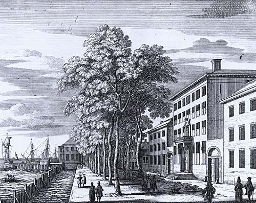
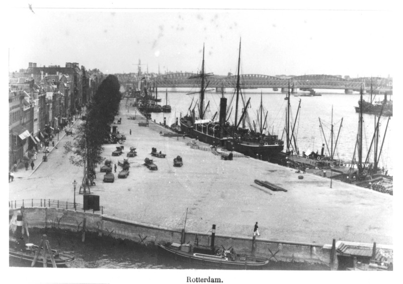
Image: Stadsarchief Rotterdam. Retrieved from https://hdl.handle.net/21.12133/C105E34E752546B8ABD1594CD16629EB
During World War II the boompjeskade was destroyed in the bombings. Nowadays the brandlijn (the border of the fire) is displayed in the ground as little lights, which you can notice all over Rotterdam. After the war the Boompjeskade was reconstructed using rubble from the bombings. In the following decades the quay changed multiple times. First with the construction of the motorway in the 1970s and 1980s, then with the addition of concrete stairs in the 1990s and finally the quay was made greener again in the 2010s.
This had all contributed to the change in the Boompjeskade when you compare it to the 17th century. Noise from the motorway carries into the city and the trees are still small in comparison to then. Also the view, which was once just a grassy polder, has changed into a more industrial city. Currently the debate on the next change is still going; The municipality of Rotterdam has plans to rebuild the motorway underground and there are plans to build more high rise buildings along the water.
Brain Teaser
How do you compare the current quality of the dyke with the 17th century? Do you feel the new plans are suitable for the area?
Sources
Meyer, H., 1999. City and Port. Transformation of Port Cities London, Barcelona, New York, Rotterdam. Rotterdam: International Books.